Research Projects
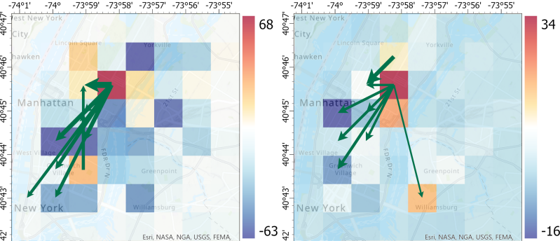
Spatial Dependencies in Urban Mobility
We propose an interpretable deep learning approach to uncover spatial relationships embedded in bike-sharing activities. We found that spatial influence does not strictly follow geographic proximity and is anisotropic. Non-member users exhibit weaker spatial dependencies in their bike usage behavior, resulting in lower short-term predictability compared to member users.
Paper:

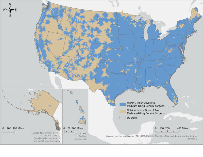
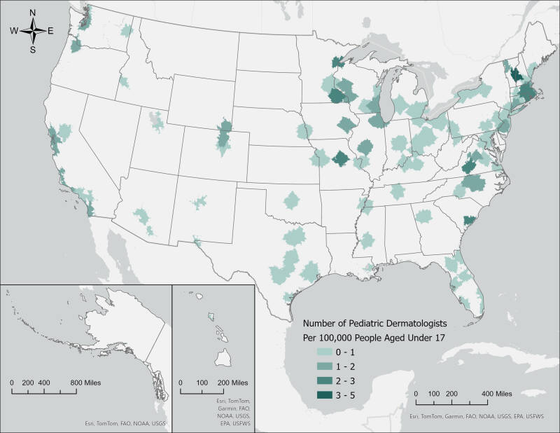
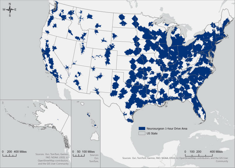
Network-based Analysis of Access Disparities to Medical Services
We delineated one-hour drive-time catchment areas for medical services using the road network and speed limits, to examine potential disparities in healthcare accessibility across different social groups.
Paper:
- A Network-Based Cross-Sectional Geographic Examination of Access to Pediatric Dermatologists Across the US
- A Network-Based Cross-Sectional Study of Geographic Access Disparities to Medicare-Participating General Surgeons in the United States
- A Network-Based Cross-Sectional Study of Geographic Access to Medicare-Participating Neurosurgeons

Environmental Perceptions and Traffic Crashes
This study investigates the relationship between the perceived built environment and traffic crashes by employing computer vision techniques and machine learning methods. The findings offer insights into the mechanistic intersection of environmental perceptions and traffic safety.
Paper:
In the Media:

Spatiotemporal Modeling of Traffic Crash Risk
Traditional crash risk assessment methods, especially those aiming for cluster detection, are subject to the modified temporal unit problem, referring to the temporal effects (i.e., aggregation, segmentation, and boundary) in cluster detection. This study employs an emerging hot spot detection approach—the prospective space-time scan statistic (STSS) method—to assess crash risk at a refined network scale and across multiple years in Hartford, Connecticut. By identifying the spatial and temporal clusters of crash risk, the study provides evidence to support neighborhood-level road safety management strategies in areas characterized by elevated crash risk.
Paper:
Web Applications

The mRFEI in the Unites States
As the principal developer, I collaborated with my co-author to design and develop an interactive dashboard that allows users to view, explore, and download census-tract-level modified Retail Food Environment Index (mRFEI) data.
Paper:
In the Media:
[Link]

Connecticut Violent Mortality Dashboard
As the sole developer, I created the Connecticut Violent Mortality Dashboard for UConn Center for Advancing Research, Methods, and Scholarship in Gun Injury Prevention (ARMS). The dashboard allows users to visualize Connecticut’s violent deaths geographically and by selected demographic characteristics.
[Link]

Puerto Ricans in the United States
As the sole developer, I created a series of interactive dashboards for the UConn Puerto Rican Studies Initiative to visualize socio-economic statistics of Puerto Ricans across the United States.
[Link]

Connecticut CRASH
I served as the lead developer for the Connecticut CRASH series of web applications.
*Showcased as an exemplary project on ESRI website >>See detail